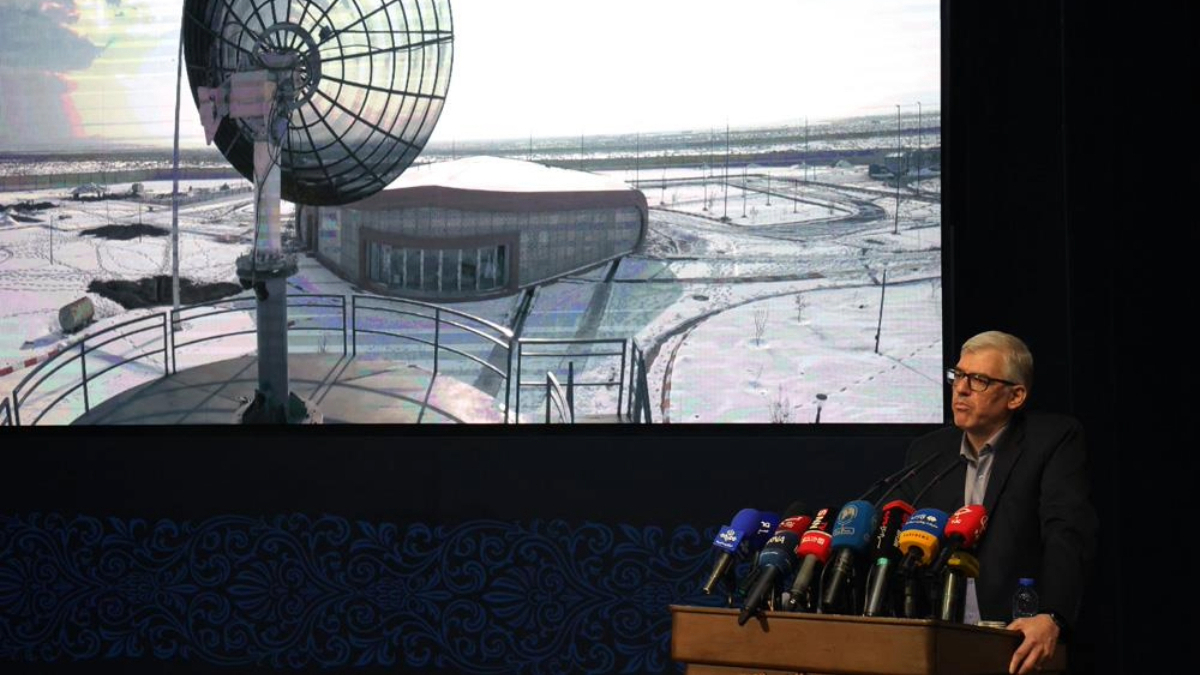
Images from Iran's Paya (Tolu 3) Earth observation satellite have been officially displayed for the first time by the Ministry of Information and Communications Technology (ICT).
They were showcased by ICT Minister Seyed Sattar Hashemi in a ceremony to commemorate the Space Technology Day in Iran on Tuesday (3 February).
“The ICT Ministry is focused on developing remote-sensing and telecommunications satellites to meet the national needs,” he said praising the role of Iranian experts and researchers to locally build it.
“This successful model can be adopted in other sectors as well,” Hashemi added.
According to the ICT Ministry, Paya’s artificial intelligence (AI) based image processing algorithms enhance its data resolution to 3 metres after black-and-white and colour images are captured by two sensors at a resolution of 5 and 10 metres respectively.
The minister said that Iran has "passed the stage of technological development" and "reached technological stabilisation" within the field of remote-sensing satellites.
Last December, Paya together with Zafar 2, and Kowsar satellites were launched onboard a Soyuz rocket from Vestochny space port complex in Russia’s Far East region of Amur Oblast.
Tolu 3 is a remote-sensing satellite with high-resolution imaging designed and built in cooperation with the Iranian Electronics Industries. It is designed for water resources management, agriculture, environmental monitoring, mapping and natural hazard monitoring.
Zafar 2 is a new generation of Zafar satellite designed and built in partnership with the Iran University of Science and Technology. Its mission is remote-sensing and collecting applied data for monitoring natural resources and land management.
The upgraded Kowsar satellite is developed with the objective of collecting operational data, monitoring agricultural lands and supporting applications related to the Internet of Things. It plays a complementary role in the country's data-driven satellite system.
The Nahid 2 was designed and built by the Iranian Space Agency and Iranian Space Research Center and was lanuched last July from Russia's Vestochny spaceport complex.
Hashemi also said that within the telecommunications satellites sector, projects such as the Nahid 2 satellite, are “an important step in the development of space-based communications”. More than 30 knowledge-based companies work with Iran's Space Research Institute on these schemes.
It is Iran's first ever telecommunications satellite in the K band, developed for the purpose of expansion of ICT services in rural and remote areas.
The Iranian minister stressed that international cooperation was also important for the development of the country’s space industry.


What is your opinion on this topic?
Leave the first comment