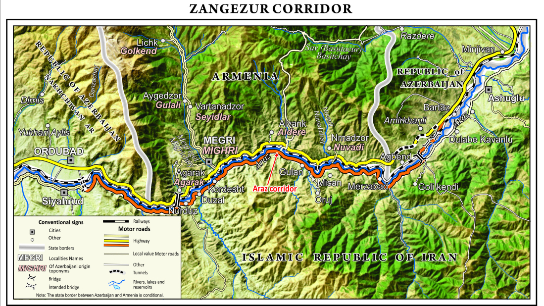
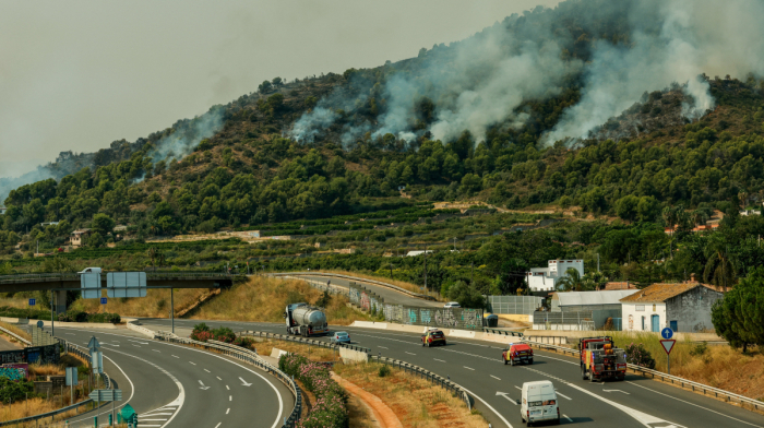
Zangezur corridor map released by Azerbaijani cartographers

AnewZ

The "Azerbaijani Cartographers" Public Union has prepared a map of the Zangezur corridor based on high-quality satellite images, showing detailed geographic features across Azerbaijan, Armenia, and Iran.

The "Azerbaijani Cartographers" Public Union has completed the preparation of a new map of the Zangezur corridor. According to the Union’s chairman, Muqabil Bayramov, the map’s base was developed using high-quality space imagery.

He said the map includes relevant sections of Azerbaijan, Armenia, and Iran, featuring settlements, roads, rivers, and mountains. The Araz corridor is also reflected in the new cartographic work.

Bayramov added that the map has been produced in both Azerbaijani and English languages.

Tags