As Central Asia expands its hydropower infrastructure and high-rise construction, seismologists are examining whether large mountain reservoirs could influence earthquake activity. The question is particularly pressing in a region where major cities lie close to active tectonic faults.
Four of Central Asia’s five capitals, Ashgabat, Tashkent, Dushanbe and Bishkek, are in earthquake-prone areas. Although decades of research have improved seismic monitoring, scientists still cannot reliably predict when a major earthquake will strike. The region is now seeking closer cooperation on disaster preparedness.
Seismological institutions from all five countries have signed a memorandum to improve scientific exchanges, while specialists from Kazakhstan, Kyrgyzstan and Tajikistan have discussed common earthquake-resistant construction standards with experts from the U.S. and Canada.
But the concerns go beyond how buildings withstand earthquakes. Large reservoirs can alter pressure within surrounding rock formations, potentially affecting existing geological faults.
China's Sichuan province quake in 2008
The possibility attracted attention after the devastating 2008 earthquake in China’s Sichuan province, which left nearly 90,000 people dead or missing.
Some researchers suggested that filling the nearby Zipingpu Reservoir, which can hold 7.8 cubic kilometres of water, may have contributed to the disaster. The theory remains disputed, and no direct causal link has been established.
Seismic risks monitored
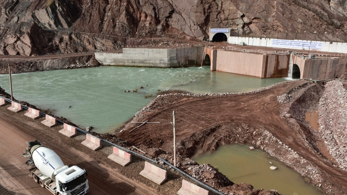
In Tajikistan, the question is far from theoretical. The country is building the Rogun hydropower plant, with a dam designed to reach 335 metres and a reservoir capable of storing 13.3 cubic kilometres of water, substantially more than Zipingpu.
Tajik seismologists have previously suggested that earthquakes in the Sari-Khosor area in 2018 and 2019 may have been influenced by the Nurek and Rogun reservoirs. The hypothesis remains unproven, but it has added to questions about how major hydropower projects interact with the region’s complex geology.
At Rogun, seismic risks are being monitored as construction progresses. The reservoir is expected to be filled gradually over approximately 16 years, while 11 seismic stations are operating around the dam and reservoir.
Managing geological risks
International engineering specialists are also involved in assessing the project’s safety. Reservoir size alone, however, is not a reliable measure of earthquake risk. The underlying geology, proximity to faults and changes in underground water pressure all matter.
In neighbouring Kyrgyzstan, the Toktogul Reservoir on the Naryn River has a capacity of around 19.5 cubic kilometres, exceeding the planned volume of Tajikistan’s Rogun Reservoir. Built during the Soviet era, it plays a central role in Kyrgyzstan’s electricity generation, while water releases also support irrigation downstream, including in neighbouring countries.
Central Asia faces a difficult balance between expanding its energy infrastructure and managing geological risks that remain poorly understood. Common construction standards and closer scientific cooperation could help, but each major project still requires detailed assessments of local conditions.
With millions of people living in earthquake-prone areas, the challenge is to ensure that infrastructure development is guided by what scientists know, while taking seriously what they have yet to establish.
Read more from Central Asia:

















What is your opinion on this topic?
Leave the first comment