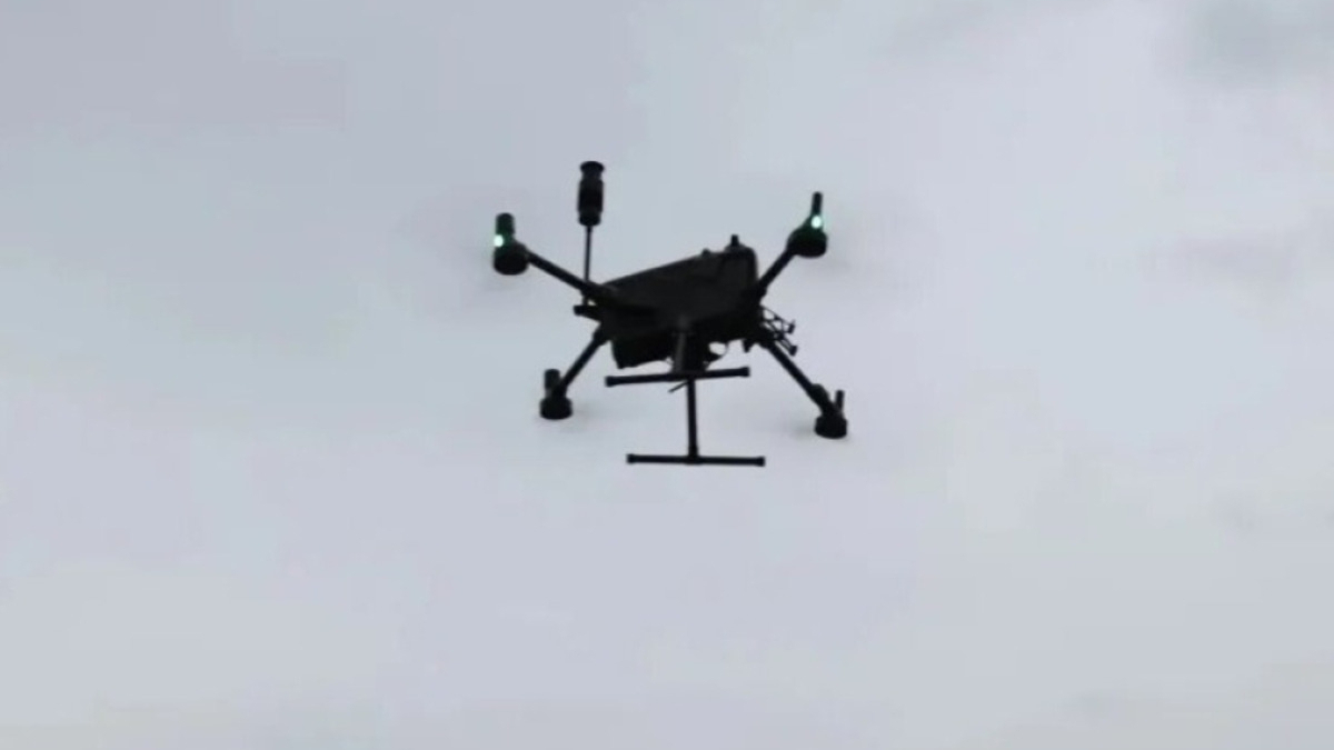
Meteorologists in China have used a swarm of drones to observe Typhoon Noul as it passed through Guangdong province, aiming to improve weather monitoring and forecasting during extreme storms.
The experiment was carried out by the China Meteorological Administration (CMA) as the typhoon made landfall along the coast of southern China, bringing strong winds and heavy rainfall to parts of Guangdong.
High-frequency observations during typhoon
A team from the Chinese Academy of Meteorological Sciences, together with the Shenzhen National Climate Observatory, conducted the drone observation project on the Dapeng Peninsula in Shenzhen.
The operation began on 24 July and continued throughout the typhoon's landfall, collecting detailed data before, during and after the storm.
The drones recorded key meteorological information, including low-altitude temperature, humidity, wind conditions and turbulence.
Filling gaps in weather monitoring
According to Guo Jianping, who led the experiment, China already operates a three-dimensional weather observation network comprising meteorological satellites, weather radars, ground-based remote sensing systems and surface weather stations.
However, monitoring the lower atmosphere beneath coastal typhoon clouds remains challenging because of heavy cloud cover and limitations in low-altitude detection.
The drone swarm was designed to address these gaps by providing more detailed observations of the storm's lower atmospheric structure.
Drones equipped with advanced sensors
The drones used in the experiment carried equipment capable of measuring wind speed, temperature, humidity and turbulence, while also capturing all-sky images.
A multi-model drone network was also established to enable simultaneous observations at different altitudes and locations.
Meteorologists used an hourly, high-frequency, three-dimensional monitoring system to track the typhoon's development and movement.
The data collected is expected to improve assessments of typhoon intensity and provide more accurate forecasts for areas affected by strong winds and heavy rainfall.
Supporting future low-altitude flight safety
The experiment also examined how extreme weather conditions affect drone operations.
Researchers collected information on flight patterns, trajectory changes and battery consumption to better understand the challenges of operating drones during severe storms.
Guo said the research will help determine safe operating conditions for drones in extreme weather and support the development of future low-altitude meteorological services.
China's low-altitude economy, including drone-based logistics, aerial inspections and emergency rescue operations, is expanding rapidly, increasing demand for accurate weather data at lower altitudes.
The CMA said the experiment will contribute to the development of a three-dimensional typhoon observation system and advance storm monitoring and forecasting technologies.















What is your opinion on this topic?
Leave the first comment