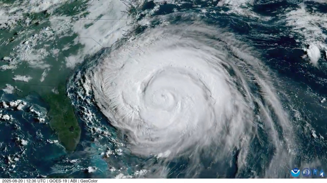
Hurricane Erin, now a Category 5 storm, is moving north in the Atlantic and is expected to bring dangerous surf, storm surge, and tropical storm conditions to the U.S. East Coast, including North Carolina’s Outer Banks.
The National Hurricane Centre warned that waves up to 20 feet could make roads impassable and cause significant beach erosion along low-lying barrier islands.
North Carolina Governor Josh Stein declared a state of emergency to mobilise resources, while storm and storm-surge warnings cover much of the state’s coastline.
Earlier in the week, the coastal counties of Dare and Hyde encompassing much of the Outer Banks, ordered evacuations for vulnerable islands such as Ocracoke and Hatteras, with ferries transporting more than 2,200 residents and tourists.
The eye of Erin, a Category 5 storm with sustained winds of 100 mph (155 km/h), is expected to move between the U.S. East Coast and Bermuda on Wednesday and Thursday.
Tropical-storm-force winds extend up to 265 miles from the centre, with hurricane-force winds reaching 90 miles.
Authorities from New Jersey to New York have issued beach closures and warnings about dangerous rip currents and coastal flooding, with flooding expected to peak during Thursday’s high tide.
Temperatures along the Northeast coast remain seasonably cool, with highs in New York City around 70 F, below the average of 82 F. Erin is the strongest Atlantic storm since Hurricane Milton in October 2024.


What is your opinion on this topic?
Leave the first comment